Mongolian Geography
![]() Mongolia is about the same size as Alaska, covering 604,247 square miles. It has also been described as being over twice the size of Texas.
Mongolia is about the same size as Alaska, covering 604,247 square miles. It has also been described as being over twice the size of Texas.
![]() It was about twice its present size previous to the 20th Century.
It was about twice its present size previous to the 20th Century.
![]() It is landlocked between Russia and China.
It is landlocked between Russia and China.
![]() Mongolia has three mountain ranges: The Altai Mountains in the far West are the highest. Near the center of Mongolia is the Khangai Nuruu range with its highest peak, Otgon Tenger Uul, at 3905m. To the NE of Ulaanbaatar is the Khentii Nuruu mountain range with its highest peak being Asralt Khairkhan Uul at 2800m.
Mongolia has three mountain ranges: The Altai Mountains in the far West are the highest. Near the center of Mongolia is the Khangai Nuruu range with its highest peak, Otgon Tenger Uul, at 3905m. To the NE of Ulaanbaatar is the Khentii Nuruu mountain range with its highest peak being Asralt Khairkhan Uul at 2800m.
![]() The lake Khovsgol Nuur contains up to 2% of the world's fresh water.
The lake Khovsgol Nuur contains up to 2% of the world's fresh water.
![]() Grassy steppes cover about 20% of the land. Less than 1% of the whole is arable. 25% is mountain forest steppe, and 8-10% of the whole is forested. About 20% is desert steppe. The rest is mountain and taiga.
Grassy steppes cover about 20% of the land. Less than 1% of the whole is arable. 25% is mountain forest steppe, and 8-10% of the whole is forested. About 20% is desert steppe. The rest is mountain and taiga.
![]()
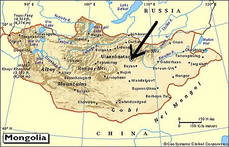
![]() this map marks my physical location with the arrow
this map marks my physical location with the arrow
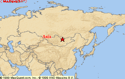
![]() this map can be clicked on to be taken to the Mapquest website and interacted with
this map can be clicked on to be taken to the Mapquest website and interacted with
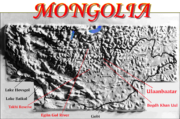
![]() below is a relief map of Mongolia, I have provided a link to the page I borrowed it from so that you can click it to interact. It has information on the places labeled.
below is a relief map of Mongolia, I have provided a link to the page I borrowed it from so that you can click it to interact. It has information on the places labeled.
~ calendar ~ where I am ~ general info ~
~ photo album ~ language ~ housing ~ food ~